LOST JEEPS
http://www.lostjeeps.com/forum/phpBB3/

Safari Day 4 Report .... a Yankee, water & a Governor
http://www.lostjeeps.com/forum/phpBB3/viewtopic.php?f=107&t=45030
Page 1 of 1

Author:  MtnLuvr [ Wed Jul 15, 2009 10:11 am ]
Post subject:  Safari Day 4 Report .... a Yankee, water & a Governor

Durangotang has had his hands full, so here's some photos of Tuesday's day runs into Yankee Boy Basin and Governor Basin to get us started:

Image
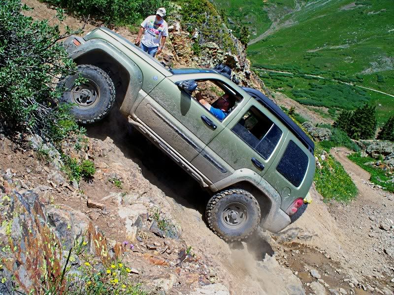
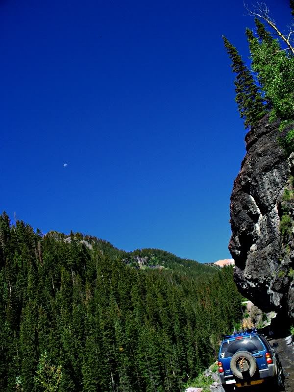
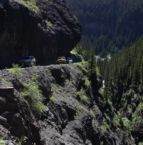
Things are pretty vertical going toward Yankee Boy Basin....

...that is unless they're hanging over you (including tskalil shown)
Image

Image
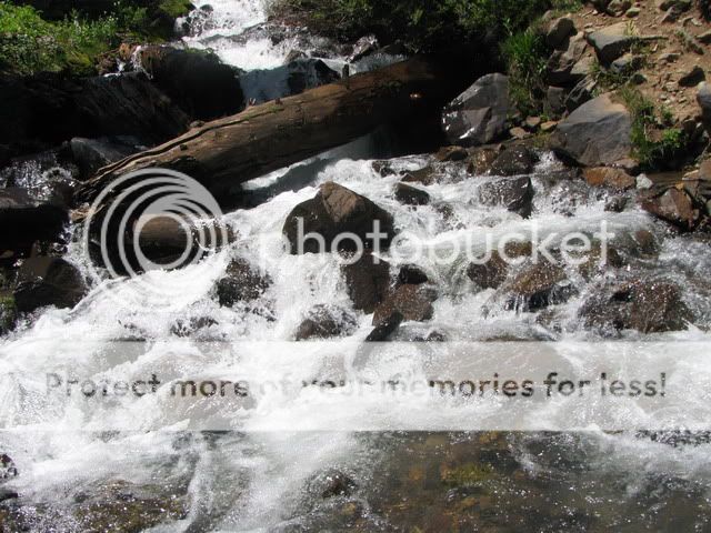
Beautiful multi-tier waterfall in Yankee Boy Basin

Image
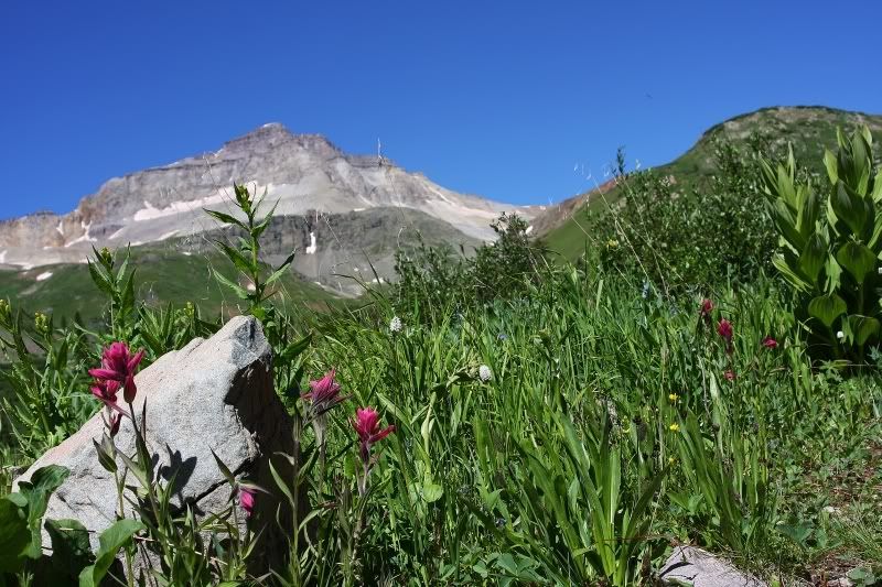
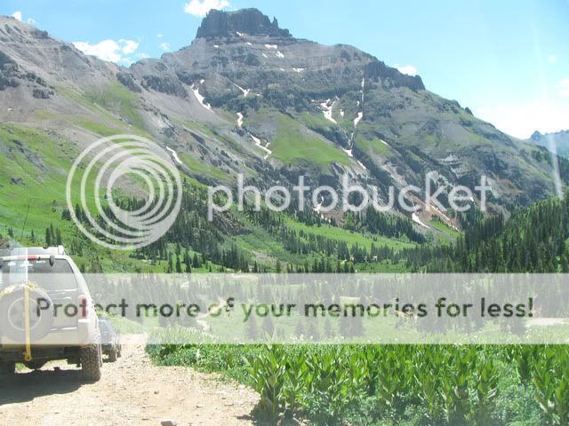
High country beauty and contrast.

Image
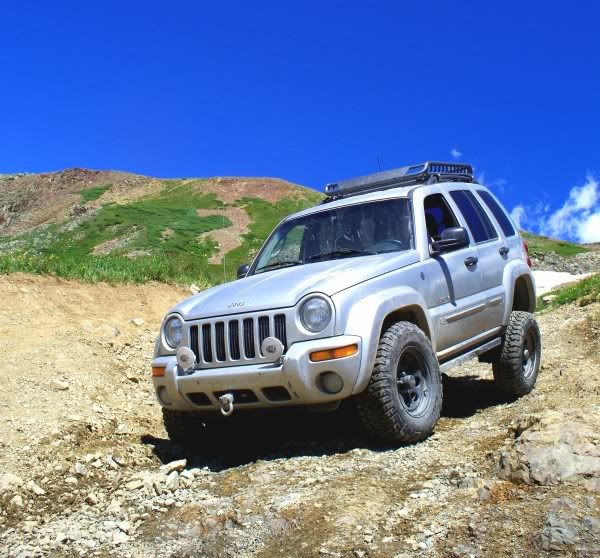
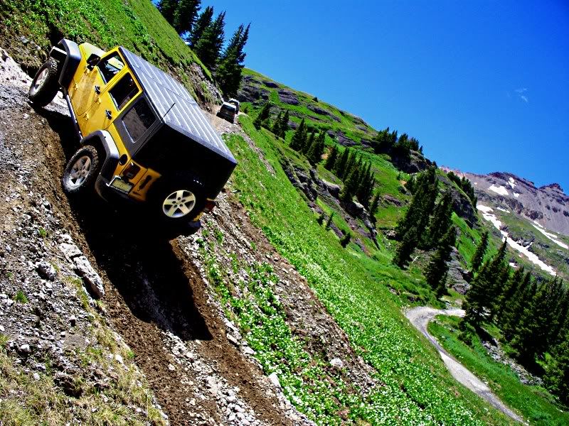
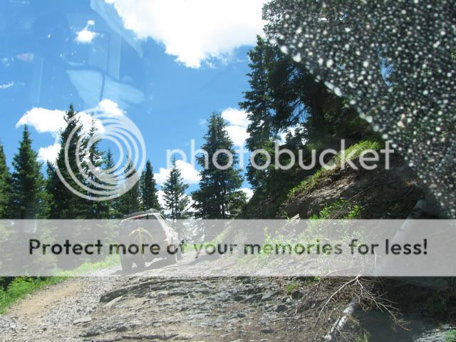
0311_DOC climbing the grade on the high side of a switchback (that is surrounded by blooming flowers)

Image
Indian Paintbrush flowers in the high country

Image
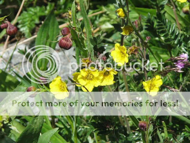
Another example of high country flowers

Image
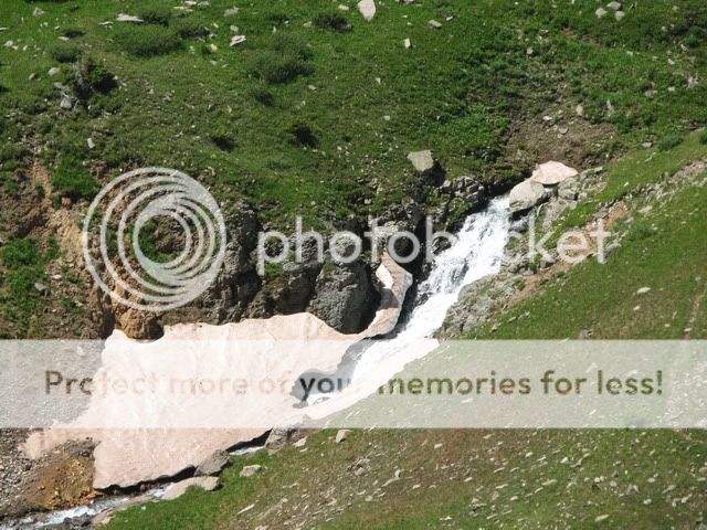
You think that snow will disappear due to the running water and sunshine before it next snows again?

Image
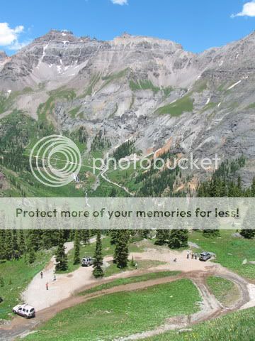
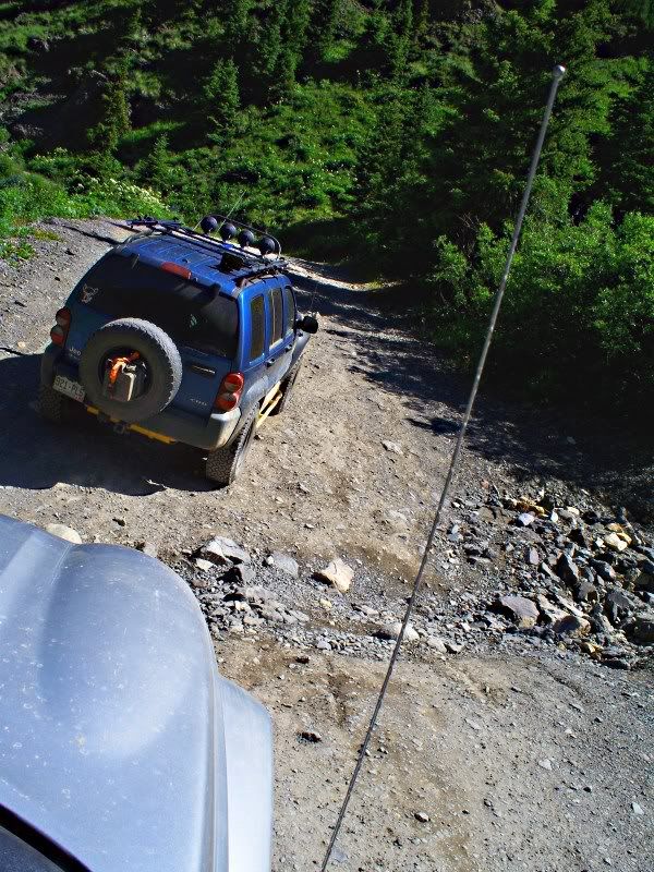
Durangotang and MP Jeeper crawling back down into the valley below Yankee Boy Basin

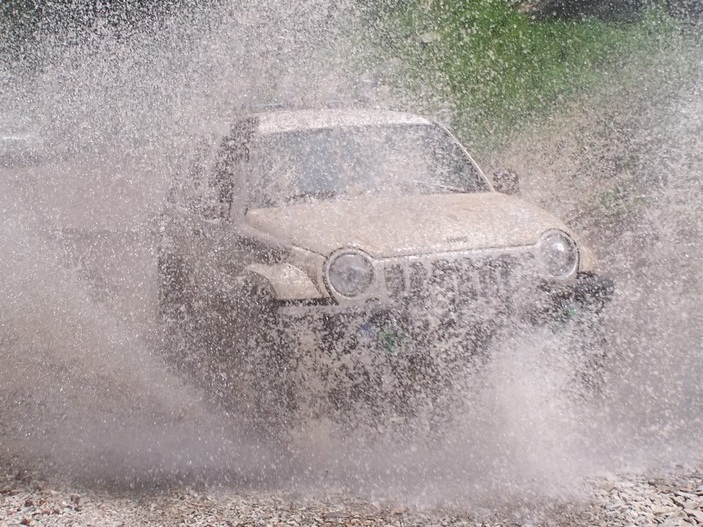
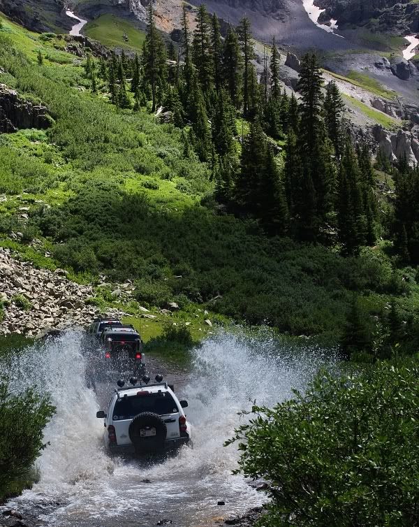
After this, we then broke into smaller groups and individuals. The first expedition group into Governor's Basin was yellowcoyote, kskj, 0311_DOC and Red & Dolly. While giving the first expedition group a headstart, the second expedition group of Strikeagle, MP Jeeper, Troysterr and MtnLuvr, stayed behind and played a little in the water:
Image
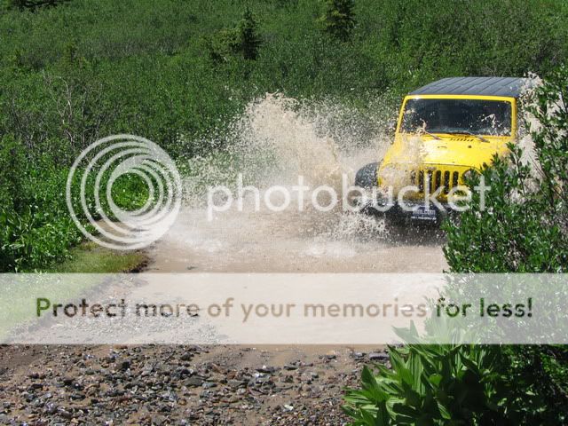
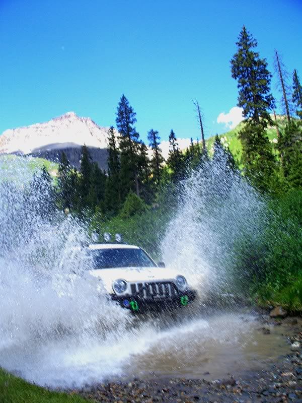
(only one of Troysterr's many runs through the water)
Image
(MtnLuvr plowing his KK through)
Image
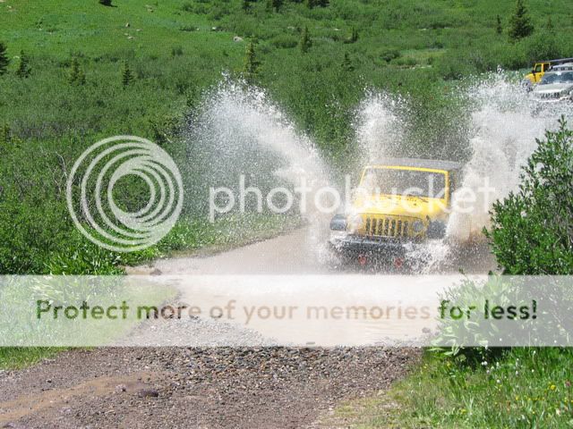
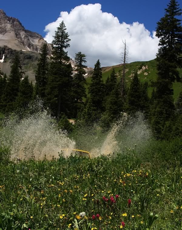
(Strikeagle plowing through. After which, his kids shouted "do it again!")
Image
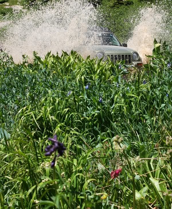
(MP Jeeper makes a splash with his KJ Renegade)

Image
Another stream crossing on the way up to Governor's Basin

Image
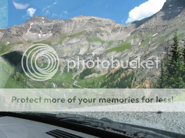
Beautiful scenery looking down into the Yankee Boy Basin where we had been earlier in the day

Image
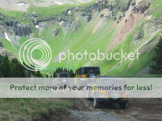
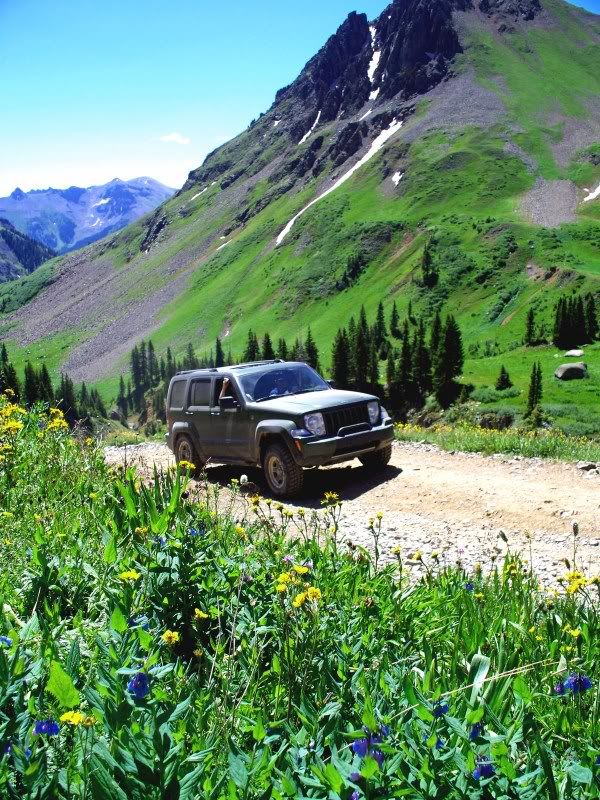
MP Jeeper leads the "green & yellow" brigade (a.k.a. expedition two) up to the peak on the way to Governor Basin

Image
A mule deer watches the group from above

Image
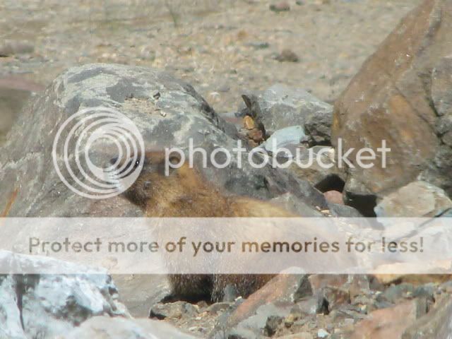
A marmot checking out some LOST Jeepers on their way back to Ouray

Author:  MtnLuvr [ Wed Jul 15, 2009 10:13 am ]
Post subject:  Continued expedition further up into Governor's Basin

After the two Governor Basin expeditions met up on a wide switchback (en route to the highest of Governor's Basin), yellowcoyote, kskj and 0311_DOC decided to hang out and relax as shown below:
Image
while Strikeagle, MP Jeeper, MtnLuvr, Troysterr and Red & Dolly decided to climb further and go all the way into Governor's Basin.

Image
After climbing down a rocky stretch, the Governor's Basin bound five continued through a rocky stretch. Notice Red's Wrangler in amongst the rock field?

Image
We finally made it to "the beach" within Governor's Basin which was pleasantly rock-free (MP Jeeper, Troysterr (in back) and MtnLuvr)

Image
The beautiful view looking down from Governor's Basin

Image
The Wranglers (Red & Dolly, Troysterr and Strikeagle) initially leading the way back out of Governor's Basin.

Author:  MtnLuvr [ Wed Jul 15, 2009 10:23 am ]
Post subject:  Night Expedition

kskj, MtnLuvr, 0311_DOC, yellowcoyote, MP Jeeper and Strikeagle all decided daytime wheelin' wasn't enough for their Libertys, so they planned, well actually kskj did, a night ride:


Image
kskj, MtnLuvr & 0311_DOC at the stop on Red Mountain. Yes, we've already turned off some of our lights for the stop.

After completing Red Mountain, we then headed to Clear Lake.

Image
0311_DOC with his Light Force lights on his roof rack led the way up to Clear Lake, followed by kskj.

After arriving at clear lake, we enjoyed turning off all the lights and checking out the highly visible star field. The lake was so calm you could see the reflection of the stars (and surrounding snow) in it.


Image
MP Jeeper (with Strikeagle riding shotgun) led the way back down from Clear Lake, followed by yellowcoyote and kskj.


According to MtnLuvr's father, we passed 28 deer and 1 elk during the course of our night expedition. Of course, since MP Jeeper didn't see the, or any, elk, the one MtnLuvr saw didn't count. Future expeditions will have to be arranged to help MP Jeeper find some elk.

Author:  AZKJ [ Wed Jul 15, 2009 3:07 pm ]
Post subject: 

Thanks for all the pics. Some of that snow you asked about will still be there when the first snow falls this winter.

I know for many of you this is your first trip into the San Juan's. Granted, the trails are very scenic, but they are not all not that difficult, even for a stock height Liberty. So, what's the general opinion of the area with it's easy to mildly moderate trails and lack of real wheeling challenges?

Enjoy the rest of your trip, we'll be up there for a week starting Sep 5th. That will make our 5th trip... we never get tired of the scenery.

Oh, I almost forgot to ask... how many rigs showed for this adventure??.

Author:  Jeephotog [ Wed Jul 15, 2009 3:18 pm ]
Post subject: 

We are heading there now and appreciate you keeping everyone updated with your pics. This will be our (we stopped counting years ago) time. Too many to count and never get tired of it. Glad you newbies are enjoying the beautiful scenery. :D

Author:  kskj [ Thu Jul 16, 2009 12:48 am ]
Post subject: 

AZKJ wrote:
Thanks for all the pics. Some of that snow you asked about will still be there when the first snow falls this winter.

I know for many of you this is your first trip into the San Juan's. Granted, the trails are very scenic, but they are not all not that difficult, even for a stock height Liberty. So, what's the general opinion of the area with it's easy to mildly moderate trails and lack of real wheeling challenges?

Enjoy the rest of your trip, we'll be up there for a week starting Sep 5th. That will make our 5th trip... we never get tired of the scenery.

Oh, I almost forgot to ask... how many rigs showed for this adventure??.


Nothing mild to moderate on day 5 wait till you see all of us made it up Poughkeepsie Gulch. :wink:

Image

Author:  kskj [ Thu Jul 16, 2009 1:03 am ]
Post subject: 

Back to day 4 pics, here is ours.

Durangotang going up yankee boy basin
Image
Image

Mtnluvr in the KK reaching the top of yankee boy
Image

Flexing on the way back down
Image

0311doc splashing through a water puddle
Image

Troyster climbing on his way to the summit of Governors Basin
Image

Author:  AZKJ [ Thu Jul 16, 2009 9:32 am ]
Post subject: 

kskj wrote:
AZKJ wrote:
I know for many of you this is your first trip into the San Juan's. Granted, the trails are very scenic, but they are not all not that difficult, even for a stock height Liberty. So, what's the general opinion of the area with it's easy to mildly moderate trails and lack of real wheeling challenges?


Nothing mild to moderate on day 5 wait till you see all of us made it up Poughkeepsie Gulch. :wink:

Image

LOL.. the dramatic effect of rotating the camera 15~20* does indeed make your pic and the last one in the post above look like some really hard core wheeling. The "Wall" on Poughkeepsie is a tough obstacle that can vary year to year. For real, how bad was it this year?

Moab and the San Juan's offer trails on the opposite end of the spectrum. What is the general opinion of the folks who have never been to Ouray before? While very scenic, are the trails offering enough of a challenge to everyone? The scenic aspect of the area is what has drawn us back year after year.

How many Jeeps have shown up for this years LOST event?

Author:  kskj [ Thu Jul 16, 2009 10:43 am ]
Post subject: 

AZKJ wrote:
kskj wrote:
AZKJ wrote:
I know for many of you this is your first trip into the San Juan's. Granted, the trails are very scenic, but they are not all not that difficult, even for a stock height Liberty. So, what's the general opinion of the area with it's easy to mildly moderate trails and lack of real wheeling challenges?


Nothing mild to moderate on day 5 wait till you see all of us made it up Poughkeepsie Gulch. :wink:

Image

LOL.. the dramatic effect of rotating the camera 15~20* does indeed make your pic and the last one in the post above look like some really hard core wheeling. The "Wall" on Poughkeepsie is a tough obstacle that can vary year to year. For real, how bad was it this year?

Moab and the San Juan's offer trails on the opposite end of the spectrum. What is the general opinion of the folks who have never been to Ouray before? While very scenic, are the trails offering enough of a challenge to everyone? The scenic aspect of the area is what has drawn us back year after year.

How many Jeeps have shown up for this years LOST event?[/img]


For one if you compare the angle of the trees to the camera you can see that it is a tad bit off, but definitely shows how steep "The Wall" is. :wink:

On another note we had only two open diff KJs make it up without a winch, the rest of the KJs had to be winched up including one with DTT in the front and an ARB in the rear. We also had 2 ripped off fenders for the day including an inner fender on one, a broken side mirror, scratches and dents to the side of a Wrangler, a smashed transfer case skid and 2 bent rims. So yeah I definitely wouldn't consider this a easy to moderate trail.

We had 10 Jeeps on the run yesterday.

To bad your missing out on the fun. :wink:

Make sure to take pics of your KJ when you climb Poughkeepsie when your up here next week. 8)

Author:  AZKJ [ Thu Jul 16, 2009 10:54 am ]
Post subject: 

You're 100% right the wall on Poughkeepsie is a very tough challenge. Hat's off to everyone for trying it, especially the open diff guys!!

I never climbed it in my KJ. My buddy has an open KJ too, so he wouldn't be of any help in getting me up and over. I'm taking the JK up there this year, and again being open, I doubt if we'll be running that trail because my buddy is still driving the KJ. Sometimes humility is the better part of valor, I'm not into trail carnage or breaking things just to say, "I did it". So, Poughkeepsie is the only trail up there that I haven't completed and I doubt I ever will.

Other than Poughkeepsie, Governor's Basin, and Black Bear (thrown in for it's pucker factor) being difficult, I'd still be interested in hearing what folks think of the San Juan's as a 4x4 destination?? Are those three trails and the scenery alone on the others enough for them to keep coming back to the area??

How about the prices for food and lodging in Ouray?? I know motel prices keep going up every year... so much in fact, we're moving our base camp to Montrose when we go in Sep.

What are gas prices up there right now at the little station on the north side of town? I believe it's a Chevron Station.

If you guys have time, do the Last Dollar Road. It's a really easy trail that winds through the Aspen forests. very scenic with the wild flowers in bloom.

Looking forward to more pictures!!! 8)

Author:  AZKJ [ Thu Jul 16, 2009 11:27 am ]
Post subject: 

yellocoyote wrote:
Very much well worth the trip... I'm already planning on returning next year. :D 8)

Pictures forthcoming when I get to a place w/more reliable internet. :roll:

Glad to here that, especially since you traveled all the way from IL to get there!! The dates aren't set in stone yet, but we'll be making our trip up there in July next year. We alternate, summer one year, fall the next.

Author:  kskj [ Thu Jul 16, 2009 11:37 pm ]
Post subject: 

What are gas prices up there right now at the little station on the north side of town? I believe it's a Chevron Station.
[/quote]


The Gas in town is 2.78 if you go 5 miles north of the KOA in Ridgeway its 2.69 We went to Ouray to eat out tonight 28.00 for two sirloin steak sandwiches and tea at the Irish pub. It was worth it, great place to eat.

Author:  0311_DoC [ Sun Jul 19, 2009 6:49 pm ]
Post subject: 

HE HE :twisted:

Image

Author:  hiram [ Thu Jul 23, 2009 4:38 pm ]
Post subject:  pics

Thanks for sharing. I have never seen anything like that before, just gorgeous!

Author:  MtnLuvr [ Thu Jul 23, 2009 8:58 pm ]
Post subject:  Re: pics

hiram wrote:
Thanks for sharing. I have never seen anything like that before, just gorgeous!


Start thinking now about getting you and yours and your Liberty to the Colorado Rockies next summer :wink:

Author:  durangotang [ Fri Jul 24, 2009 6:48 pm ]
Post subject: 

OK... my internet works again and I can upload pics :D

The group heads up Camp Bird Road for a relaxing day in Yankee Boy Basin... if only it had turned out that way :lol:

Image


Once again, welcome to the San Juan Mountains.... Stony Mountain in the distance.

Image


The group all shuffled up into the basin but we learned (at an opportune and rather narrow moment) that the forest service had closed the trail to the top. The had to do a nice little shuffle on a narrow switchback to get everyone pointed downhill once again.

Image

The group stopped on a small spur trail to soak in the views, eat some food, and play in the a conveniently placed water crossing :D This was to be our first cloudless day in the mountains...

0311_Doc in the water... again...
Image

MP Jeeper washes his dogs...
Image

Can you find the LOST Jeeper in this pic?
Image

Author:  AlterCow [ Fri Mar 12, 2010 1:00 am ]
Post subject:  Re: Safari Day 4 Report .... a Yankee, water & a Governor

Epic riding, folks! Killer JEEPs and awesome views. It makes me wish it was summer here. At least the snow drifts reaching my roof line are only 7 feet tall, now. I sure sign that Spring is right around the corner.

My wife, the runner, runs Imogene Pass every year.

The San Juans are my back yard, but I still do not have a lot of expereince in them. I am somewhat familiar with the trails around Silverton, but not to the north in Ouray. Before I get back out there this year I think I need to upgrade my OEM tires with something a bit more durable.

I hope to post some of my pics of California Pass and Animas Forks in a few days.

Thanks for turning me on to this site, mntnlvr.

Author:  MtnLuvr [ Fri Mar 12, 2010 1:10 pm ]
Post subject:  Re: Safari Day 4 Report .... a Yankee, water & a Governor

AlterCow wrote:
....Thanks for turning me on to this site, mntnlvr.


Welcome to LOST.

Page 1 of 1 All times are UTC - 5 hours [ DST ]
Powered by phpBB © 2000, 2002, 2005, 2007 phpBB Group
http://www.phpbb.com/