Every time I go to the Badlands, I feel like I am lost. That is not a feeling I like unless we are talking about the club
Does anyone have ideas on how to help with this project?
| LOST JEEPS http://www.lostjeeps.com/forum/phpBB3/ |
|
| Badlands mapping project http://www.lostjeeps.com/forum/phpBB3/viewtopic.php?f=26&t=12735 |
Page 1 of 1 |
| Author: | Science_Guy [ Sat Sep 23, 2006 7:58 am ] |
| Post subject: | Badlands mapping project |
Every time I go to the Badlands, I feel like I am lost. That is not a feeling I like unless we are talking about the club Does anyone have ideas on how to help with this project? |
|
| Author: | LostRenegade [ Sat Sep 23, 2006 8:08 am ] |
| Post subject: | |
It sounds like a pretty good idea and a fun one to. |
|
| Author: | moose [ Sat Sep 23, 2006 9:52 am ] |
| Post subject: | |
Eddo did a great job of this on our Slade, KY run; you may want to pm him. I don't understand my eTrex yet, but my wife does, and she will have it on the run. |
|
| Author: | Science_Guy [ Sat Sep 23, 2006 9:54 am ] |
| Post subject: | |
LostRenegade wrote: It sounds like a pretty good idea and a fun one to.
PM sent |
|
| Author: | corwyyn [ Sat Sep 23, 2006 2:25 pm ] |
| Post subject: | |
If you have access to a laptop/notebook you might consider getting USA Photo Maps at jdmcox.com. It lets you download aerial and topo maps from the Microsoft Terraserver site and use them with you GPS. I got some info on this from a guy in the AZ Virtual Jeep Club and was going to test it out on the Walnut Canyon run until I found out my LBJs were going out. Heres a couple of screen grabs: Aerial photo map: 
Topo map of same area: 
Its kinda like having Google Earth on your laptop without the need for the internet connection. Note that the topo maps can be quite old - 20 years or more depending on location. But given how slow things tend to change in rural areas it might not matter. I'm going to try this out hopefully next week when I go on a camping trip up on the rim. Speaking of Google Earth, if you are running that you can upload tracks to it. It has a GPS function that is enabled if you get a subscription but I haven't been able to get it to work. I just download my tracks and convert them to .gpx files which GE can read without the need for a subscription (I think). Heres a screen grab from a portion of the track I made going thru Bulldog Canyon: 
PM or e-mail me if you have any questions. |
|
| Author: | KJ-BOL [ Sat Sep 23, 2006 4:44 pm ] |
| Post subject: | |
This was an idea that maybe we can do now that there is a bit more interest... I'm in for it - I'm sure pixeldzn is all for it too. heck - I don't see why all of us can pitch in for this idea to take off.. |
|
| Author: | Science_Guy [ Mon Sep 25, 2006 5:13 pm ] |
| Post subject: | |
Good to hear we have interest. I am still looking over the software options that are available. I am strongly considering buying TOPO! for this. I am not too impressed with the MapSource application and the USAPhotoMaps is nice for free but I want something that is VERY nice so others will want to use it also. TOPO! cost about $99 for Indiana, Ohio, and MI. I will make a few calls to see if I can not get a local store to donate a copy to my "classroom" GPS project |
|
| Author: | LostRenegade [ Mon Sep 25, 2006 9:19 pm ] |
| Post subject: | |
Here is another useful tool that is recommended by Geocaching.com. http://www.easygps.com/default.asp It is not very sophisticated, but will plot the track for you. There is another version called ExpertGPS that will also show topo and satellite photo. http://www.expertgps.com/default.asp Enjoy, |
|
| Author: | Science_Guy [ Mon Oct 16, 2006 12:12 pm ] |
| Post subject: | |
As we get closer to the holloween run, I wanted to get an idea on how many of you plan to bring a GPS on the run. I have several I can use if we dont have at least one GPS with each group. I would like each group to have at least one. I will also have my laptop along to download the tracks. You can also just send me your tracks as a file later if you like. Does anyone have tracks from past trips? |
|
| Author: | moose [ Mon Oct 16, 2006 12:22 pm ] |
| Post subject: | |
Science_Guy wrote: As we get closer to the holloween run, I wanted to get an idea on how many of you plan to bring a GPS on the run. I have several I can use if we dont have at least one GPS with each group. I would like each group to have at least one. I will also have my laptop along to download the tracks. You can also just send me your tracks as a file later if you like. Does anyone have tracks from past trips?
moose is (who am i kidding) - moose's wife is bringing HER garmin etrex vista cx & usb cable..... |
|
| Author: | KJ-BOL [ Mon Oct 16, 2006 2:17 pm ] |
| Post subject: | |
I'll be bringing a GPS as well |
|
| Author: | meduncan [ Mon Oct 16, 2006 2:21 pm ] |
| Post subject: | |
Mine's built into the dash so I'll have to bring mine. Don't know how much help the RB1 will be with your mapping project though since I can mark a trail but can't export the tracks from it. |
|
| Author: | Science_Guy [ Sun Oct 29, 2006 8:11 am ] |
| Post subject: | |
Here is a draft of the run from yesterday. As you can see, there were several places I lost sat signal. I will work to repair the tracks and add more landmarks. 
|
|
| Author: | Science_Guy [ Sun Oct 29, 2006 1:50 pm ] |
| Post subject: | |
Here is the same basic map in google earth: 
Waypoint 001 dunes 002 rock quarry 003 camper in the woods 004 house 005 tunnel bridge 006 office/air station |
|
| Author: | bugnout [ Sun Oct 29, 2006 7:15 pm ] |
| Post subject: | |
I didn't realize we were right near the Erie canal right of way. I didn't know it extended that far into Indiana. |
|
| Author: | pixeldzn [ Sun Oct 29, 2006 10:10 pm ] |
| Post subject: | |
Dude, this is great. I think we can make things much easier on ourselves once we refine this a bit on a few more runs for sure! |
|
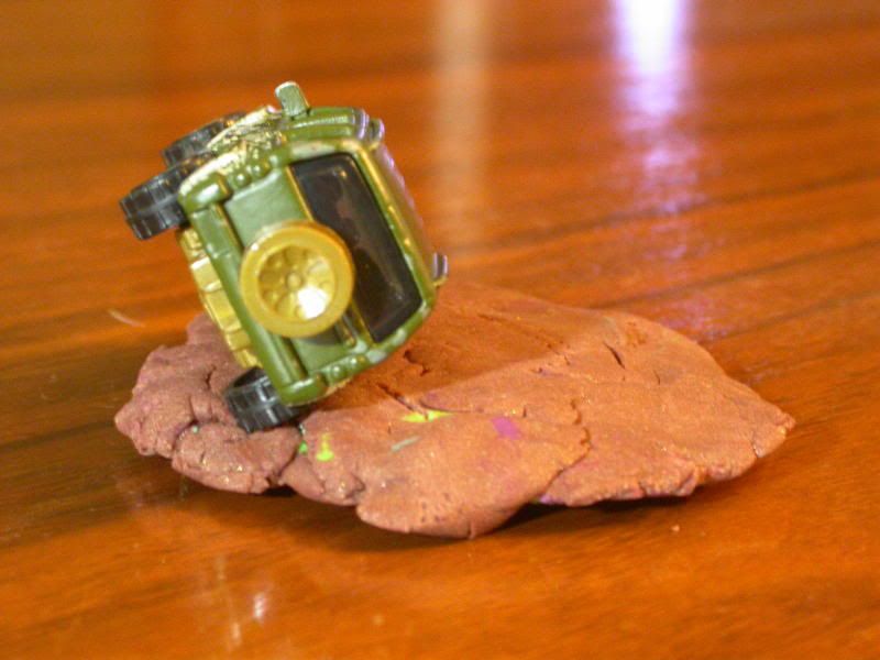
| Author: | Bakerkj [ Thu Nov 02, 2006 12:15 am ] |
| Post subject: | |
I can't upload or download from my gps, so I'm starting a 1/1000 scale model of the Badlands. I already have the tubes and Beef eater ready. 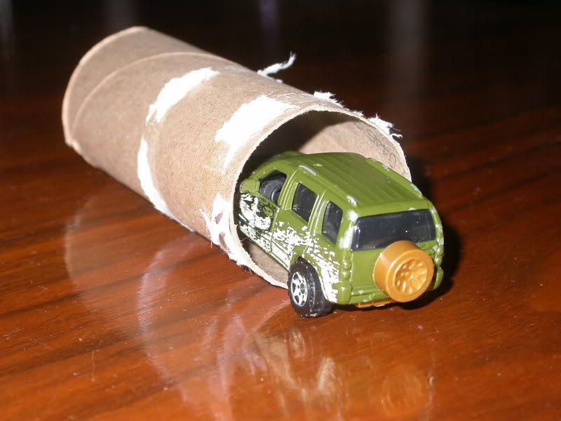
|
|
| Author: | Science_Guy [ Thu Nov 02, 2006 7:00 am ] |
| Post subject: | |
Not sure I should use |
|
| Page 1 of 1 | All times are UTC - 5 hours [ DST ] |
| Powered by phpBB © 2000, 2002, 2005, 2007 phpBB Group http://www.phpbb.com/ |
|