LOST JEEPS http://www.lostjeeps.com/forum/phpBB3/ |
|
Kansas Libertys (KJ & KK) Cool Off in the Rockies (2011) http://www.lostjeeps.com/forum/phpBB3/viewtopic.php?f=53&t=61973 |
Page 1 of 1 |
Author: | MtnLuvr [ Mon Aug 08, 2011 8:19 pm ] |
Post subject: | Kansas Libertys (KJ & KK) Cool Off in the Rockies (2011) |
kskj and I, both from Eastern Kansas, have been in off-roading withdrawal since Pastafari 2011, even though we hit the rocks of Kansas at Tuttle Creek in July. Plus, we were getting way too tired of the crazy heat hitting us in July where every day after work, the outside thermometer in our Libertys read something like this: ![]() So...given that I was going to be in the Colorado-New Mexico area for some other matters, kskj drove out to meet me so we could enjoy the free air conditioning offered by the Rocky Mountains (specifically in the Arkansas Headwaters area around Salida, Buena Vista & Leadville, Colorado). Here's a little trip report from a couple Kansas-based Libertys from our Rocky Mountain cool-off Jeeping ![]() |
Author: | MtnLuvr [ Mon Aug 08, 2011 8:21 pm ] |
Post subject: | Prior to MtnLuvr meeting up with kskj |
For my trip, with my dad joining me riding shotgun, I loaded up the KK for 10-days on the road: ![]() ![]() While my dad and I were on the first leg of our trip (1/2 week before meeting up with kskj), including Jeep camping in Colorado at 10,600 ft... ![]() ...during one of our days while out and about in the Jeep, we had to stop on the road as we saw: ![]() a bear. ![]() She kept coming closer toward our stopped KK (must've liked the bumpers ![]() ![]() ...then we noticed something else in the bushes behind her, and I say her, because once we saw the cub, we knew this was a sow black bear and her cub: ![]() This would turn out to be 2 of the 3 bears we'd see on this CO-NM trip, not to mention tons of mule dear, tons of marmots, tons of ground squirrels, pikas, praire dogs and mountain goats. ![]() Now on for some Rocky Mountain Jeeping reporting.... |
Author: | MtnLuvr [ Mon Aug 08, 2011 8:22 pm ] |
Post subject: | Day 0-Cottonwood, Tomichi, Marshall Passes & Lime Ridge |
After making our sweep from Southern Colorado down to New Mexico and then back up to Colorado, my dad and I spent a quick night at the KOA in Buena Vista, Colorado: ![]() View from our KOA Kabin of part of the Collegiate Peaks area above the Arkansas Headwaters valley. Morning temps in the low 50's to upper 40's felt wonderful. We reloaded the KK to do some light off-roading before kskj would arrive in the area later that night.... ![]() Heading up easy Cottonwood Pass Trail to see how long it takes from Buena Vista to the Western side (by Taylor Park Reservoir). ![]() ![]() Still some low cloud/fog on the Western side. Got the top rack of the KK loaded too. ![]() ![]() ![]() MtnLuvr's TanKK loves being back up in the mountain high country. ![]() ![]() Chillin' by a mountain stream on the way to Gunnison after leaving the Taylor Park Reservoir area Western end of Cottonwood Pass Trail. ![]() Now off to check out Tomichi Creek and Tomichi Pass Trails. ![]() Crusin' the KK through the tree-lined trail. ![]() Wildflower season in full swing. Just one of many meadows full of colorful mountain flowers. ![]() ![]() Sitting up on Tomichi Pass just shy of 12,000 ft elevation (above sea level). Since we were going to do Hancock Pass Trail nearby with kskj later in the week, we didn't go any further than Tomichi Pass, so we turned around and went back down the way we came in. ![]() Again cruisin' through the pines. ![]() Crossing a little water here and there. ![]() Stopped and checked out Tomichi cemetery. Many of the graves were barely distinquishable, had only rock outlines, had only rotted wooden crosses, etc., but a few had carved stone tombstones, including this one for this 31 year old "killed by explosion" in 1890 (presumably related to area mining activities). ![]() After returning to US-50, we popped on over briefly to Marshall Pass Trail to hit Lime Ridge Trail. It was a nice, off-the-beaten-path trail, including a lot of wheeling in the aspens. Lime Ridge is also where we saw our 3rd bear, a sub-adult, but we couldn't get a camera turned on and on him before he bolted up the steep adjoining hillside into the bushes. ![]() A field of aspens on Lime Ridge with all the antler rubbings on the bark of the aspens. ![]() Speaking of antlers, here's one of the many mule deer we saw on Lime Ridge. ![]() Since the day was starting to get long and we still had to get to our next campground to setup camp and meet up with kskj, after Lime Ridge, we took Marshall Pass Trail to get up and over the Contential Divide down into Salida, CO. ![]() Dodging some free-range cattle along the way.... ![]() ...and more mule deer. Made it to our Salida, CO area campground barely before dusk to start setting up camp for our next 4 nights. kskj rolled into camp late that night where we got camp setup just before the rain hit. |
Author: | MtnLuvr [ Mon Aug 08, 2011 8:23 pm ] |
Post subject: | Day 1-Bonanze OHV Tour |
![]() MtnLuvr (and his father) and kskj (and his older son) at our campground getting ready to roll for the first day of Kansas Liberty wheeling to cool-off in the Rockies. For our first day, we decided to do the Bonanza Off-Highway Vehicle Tour South of Salida, CO. ![]() We started the tour by taking the Otto Mears Toll Road (Gulch) Trail to Bonanza. ![]() kskj's Rene is ready to climb some trails. ![]() MtnLuvr's KK on a typical shelf road. MtnLuvr's father was glad at least these shelf roads weren't as bad as some in the Ouray, CO area from LJS 2009 (and these had trees on the lower sides ![]() ![]() Little stop to enjoy the view (and probably water some plants). ![]() Stopped to check out the Exchequer ruins and cemetery. Was very surprised that Bonanza is a small town with people living there. Thought it would be a historic mountain ruins townsite. Oops. ![]() Then we did the uneventful Kerber Creek/Slaughterhouse Trail, with a lunch stop near Mosquito Lake. ![]() kskj cruisin' through the aspen forest. ![]() MtnLuvr's father is into street rods, so even this old truck cab heap catches his eye. ![]() We took the Alder Creek Trail down from the ridge line to US-285. Then it was back up, but this time on the much more interesting Whale Hill Trail. (Sorry, but I may have a couple photos out of order or unnamed as I'm doing this from memory without the notes my dad took) ![]() Too many mountain winter snows have crushed this old building flat. ![]() ![]() Cool old mine site. (sorry, currently can't confirm name) ![]() kskj's KJ Renegade and MtnLuvr's KK at a stop at another neat mine site. ![]() ![]() kskj climbing the hill. ![]() Wonderful 360 degree mountain views from the top of the hill. (Would've been even better without the cloud cover) ![]() kskj coming back down......I don't even know what that orange thing is sticking out the side of his KJ is ![]() ![]() Low tree ahead for MtnLuvr's KK. ![]() Nice range view from top. ![]() Tundra trail on the ridgeline. ![]() Marmot checking out the Libertys. ![]() Passing more old cabin ruins. ![]() The trail GPS is showing a lot of switchbacks for our descent down back into Exchequer old townsite. ![]() Another break to checkout another old mine site. From up on the ridge, took Clover Creek back down to US-285. Whale Hill and Clover Creek trails have many old mine sites along them. Between that and the wheeling, these are probably the best trails in the Bonanza Off-Highway Vehicle Tour trail system. ![]() Back at camp, I bust out some tools to tighten my CB antenna mount. ![]() After our first day wheeling together, a nice steak dinner at camp before heading out for our night ride.... After dark, we head up to North Fork Reservoir (below Billings Lake). ![]() MtnLuvr's KK fired up with headlights, OEM fog lights, dual 4" PIAA lights integrated into the bumper and dual 6" KC HiLites mounted to the full-width brush guard on the KK. ![]() The extra off-road lights really help light-up the trail ahead so much better than just the stock OEM lights. ![]() ![]() kskj's Renegade lights the way with his headlights, OEM fog lights, dual 4" bumper-mounted lights and Renegade lightbar (10 lights in all ![]() We hung out at pitch-black North Fork Reservoir and just star-gazed for awhile. It was great (in addition to a little cold at over 11,000 ft). A nice first day (and night) of wheeling in the mountains ![]() |
Author: | MtnLuvr [ Mon Aug 08, 2011 8:23 pm ] |
Post subject: | Day 2-Hancock & Tincup Passes, Pomeroy & Grizzly Lake Entry |
Second day of wheeling starts off on the Hancock Pass Trail. ![]() ![]() A stop at the Mary Murphy Mine (if I recall correctly). Then we take a side trip on the Pomeroy Lakes Trail.... ![]() Nice forested and rocky trail to the lakes. ![]() The KK parked in the bowl up by Pomeroy Lakes. ![]() The lakes as a small puffy cloud casts a shadow on the background mountain. ![]() kskj heading back down from Pomeroy Lakes back to the Hancock Pass Trail. Beautiful background scenery. ![]() A little perspective as kskj continues down the trail. ![]() Uh, are you sure you should park there long? ![]() A quick visit to the Hancock townsite to read about the town's history. ![]() On the way to Hancock Lake (side spur). ![]() Blooming flowers local to Hancock Lake. ![]() Hancock Lake. ![]() Pink Indian Paintbrush wildflowers in full bloom. ![]() ![]() No shortage of wildflowers (both in quantity and variety) in the high country this time of year. ![]() MtnLuvr's father checking out the views. Now off to Hancock Pass itself... ![]() Careful, those will leave larger than usual "nature's pinstripping". ![]() A nice mountain meadow at one of our stops heading up to Hancock Pass. ![]() Mountain high country juxtaposition with tons of wildflowers growing and blooming in front of remaining snow patch. ![]() ![]() kskj still climbing higher. ![]() The KK always ready for more climbing. ![]() Part of the trail up to the pass. ![]() Having lunch up on Hancock Pass. It was windy. ![]() Another marmot checking us out. ![]() Heading back down the backside of Hancock Pass. ![]() Taking the shelf road to check out the Alpine Tunnel area. ![]() This marmot was so surprised by us that it couldn't make it to one of its holes in time, so it climbed up the rocks above the shelf road. Seen tons of marmots in the Rockies and never seen one do this. Maybe he was just showing off... ![]() The Alpine Tunnel train station and ruins area. ![]() Up and over Cumberland Pass to the town of Tincup. ![]() kskj enjoying a peaceful moment at Mirror Lake. ![]() A chipmunk watches to see if we drop any crumbs from our snacks. We didn't because we know feeding the wildlife is bad for them. ![]() kskj's son like to make a splash on the way up the backside of Tincup Pass Trail. ![]() kskj's Rene (with his son driving) working a little rear flex on the trail rocks. ![]() The KK with what I call the front side (e.g. St. Elmo side) of Tincup Pass in the background. ![]() Only 12,000+ feet for this mountain pass....tomorrow, we'll have to climb higher ![]() ![]() MtnLuvr's KK and kskj's KJ at Tincup Pass. ![]() Heading back down in the rain. Now that we had completed our intended trail loop, MtnLuvr wanted to stop by the beginning of Grizzly Lake Trail and check out the beginning 6-rated rock obstacle. ![]() MtnLuvr decides to cross the creek and try the rock obstacles, with kskj spotting from above.... ...well, my first line wasn't quite right and close to getting my front wheels over the top, I started to slide sideways and off-camber. So, like any wheeler, I decide to back down and try again, only I wound up with my rear drive shaft sitting on a rock. ![]() ![]() ...bust out the winchline ![]() ![]() ...and use my winch to lift my KK up off the rock I had the drive shaft sitting on. Then I decided to go ahead and fully test out my Warn 9.5XP winch and have it drag the KK up the full set of rock obstacles. Love my KK High-Clearance, Heavy Duty, Front Off-Road Bumper ![]() We didn't have time to do the entire Grizzly Lake Trail, so with kskj riding shotgun, we did a quick loop (after disconnecting and respooling the winch line) and came back down. ![]() Coming back down showed why you need Heavy Duty Rock Rails (preferrably with Slider Rails). ![]() Doing a little rear flex coming down (and somehow clearing my Heavy Duty Basic Rear Bumper). ![]() Clearing the last little step to go back across the creek so we could head back to camp. What a great day of wheeling in the Rockies. ![]() |
Author: | MtnLuvr [ Mon Aug 08, 2011 8:29 pm ] |
Post subject: | Day 3-Mosquito, Browns & Marshall Passes & Mt Bross 14,000ft |
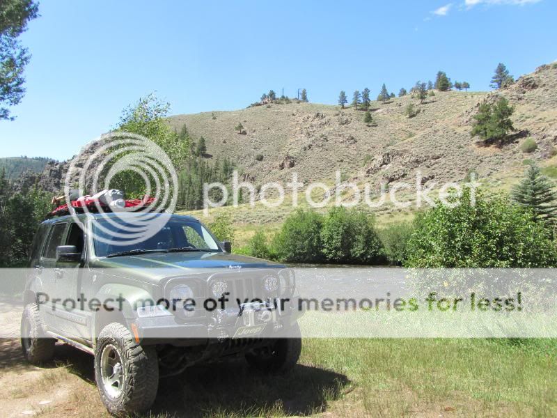
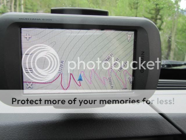
For our last day of wheeling our Kansas Libertys in the Rockies this trip, we chose to do some trails to take us up high.... ...so first we drove North to Leadville, CO then headed off on the Mosquito Pass Trail (even though it was reported to have only barely opened via winching across snow fields less than two weeks before ![]() ![]() 
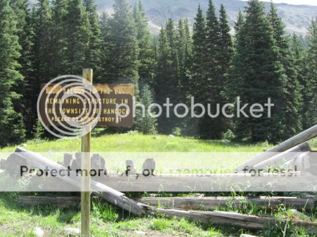
When you see a sign like this in the moutains, you know there's a good chance the trail will be enjoyable. ![]() ![]() 
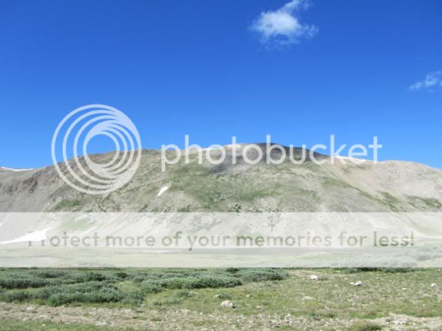
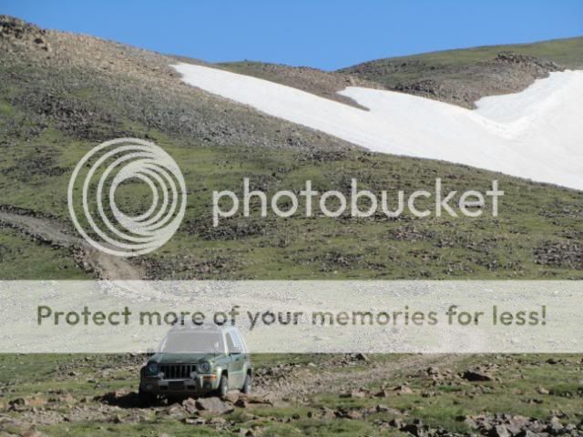
The mountain ranges around Leadville all seem to be carrying a little more snow patches than those around Salida and Buena Vista. ![]() 
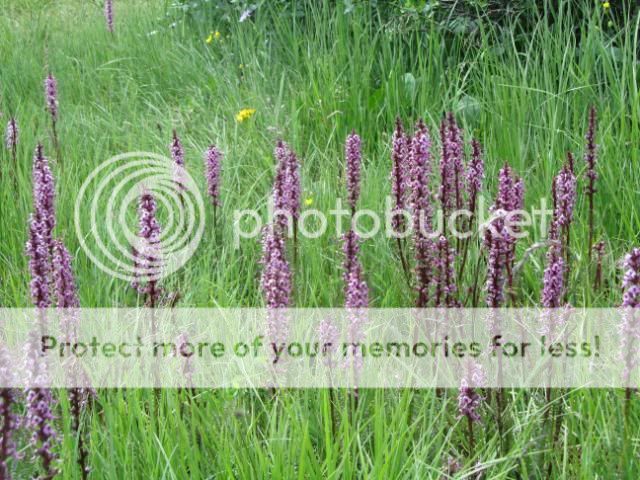
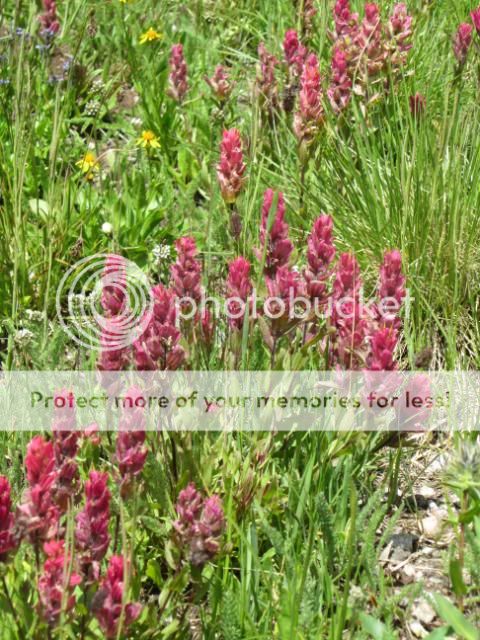
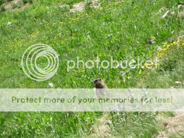
These mountain wildflowers knew where to aim to find the morning sun. ![]() 
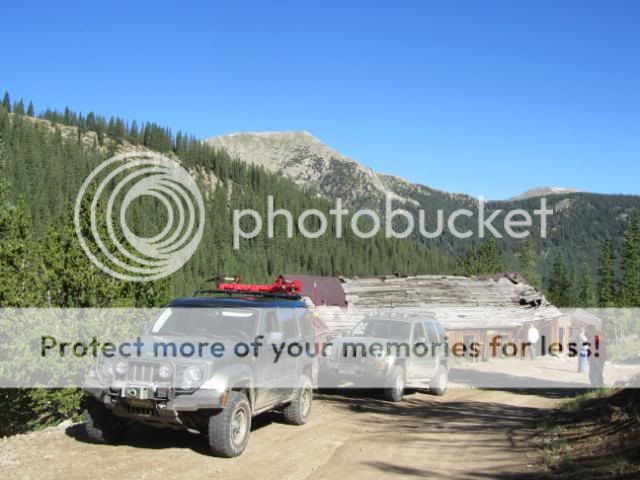
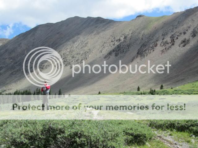
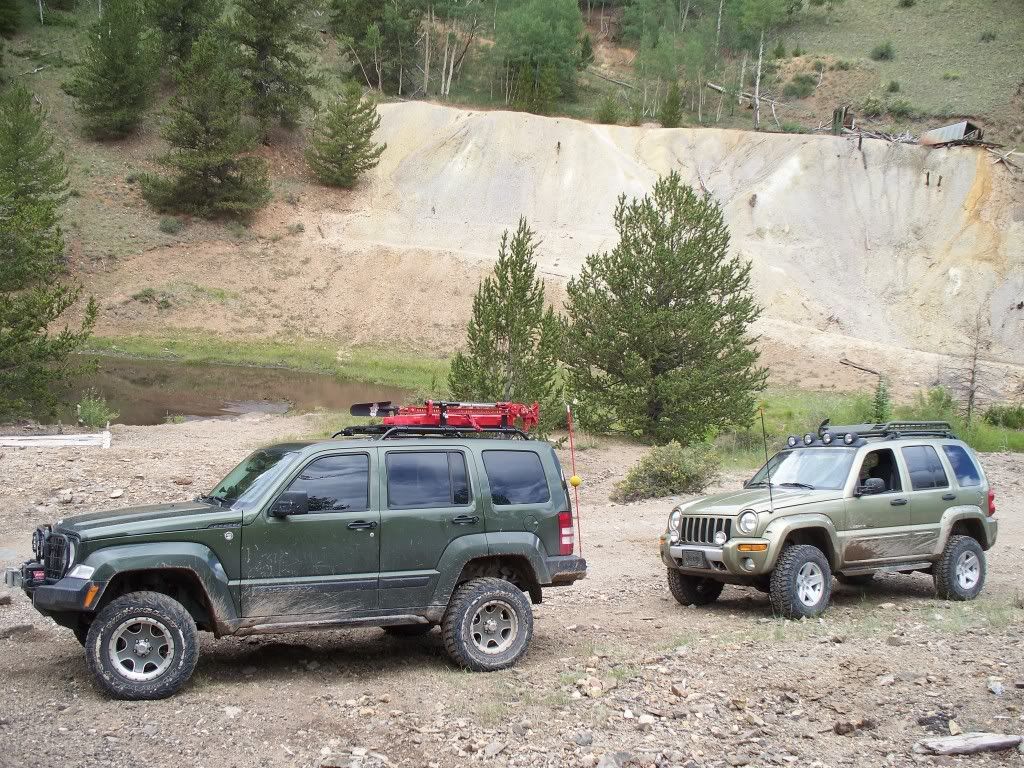
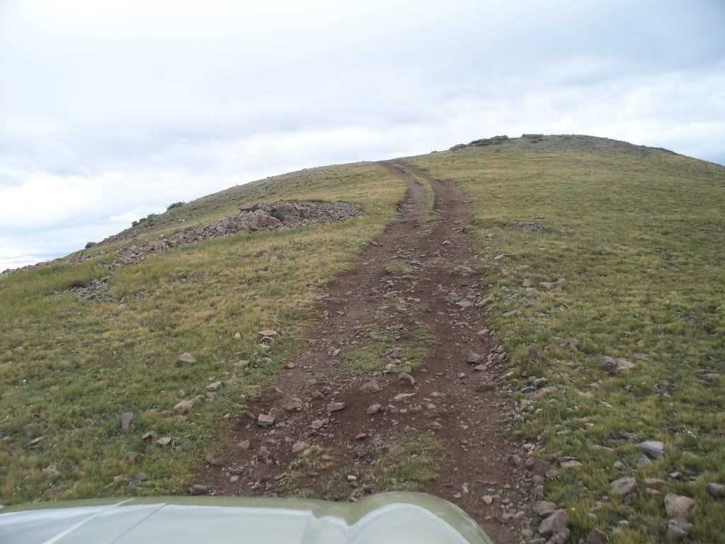
Climbing the trail with lakes and mine ruins in the background. This area is covered with mines. ![]() 
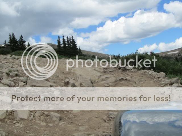
Write your own caption, but we're still climbing at 12,000 ft.... ![]() 
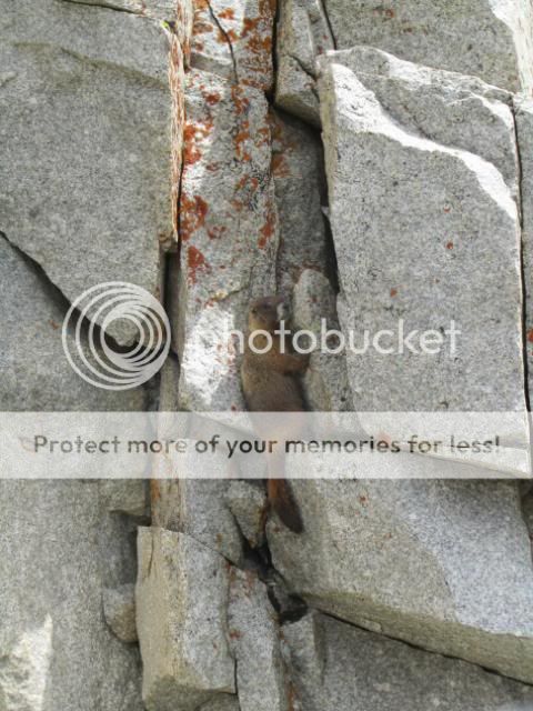
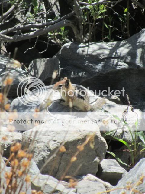
I don't know what kind of plant this was growing beside the trail above 12,000 ft, but it looked kinda alienish to me. ![]() 
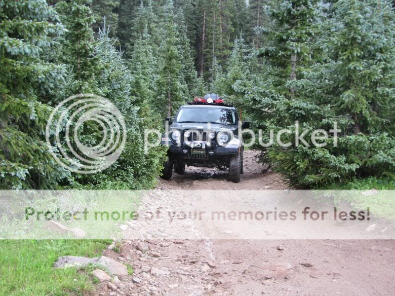
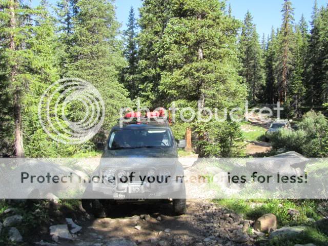
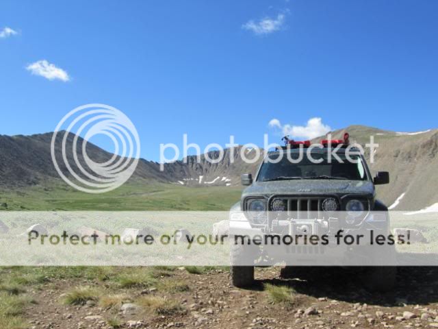
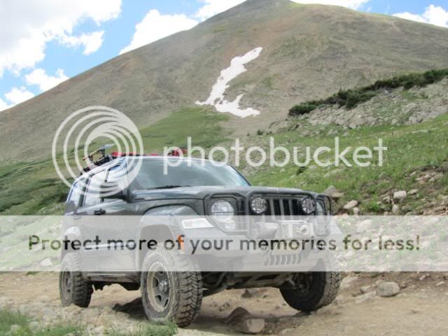
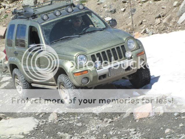
kskj climbing Mosquito Pass Trail. ![]() 
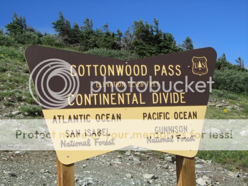
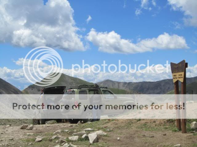
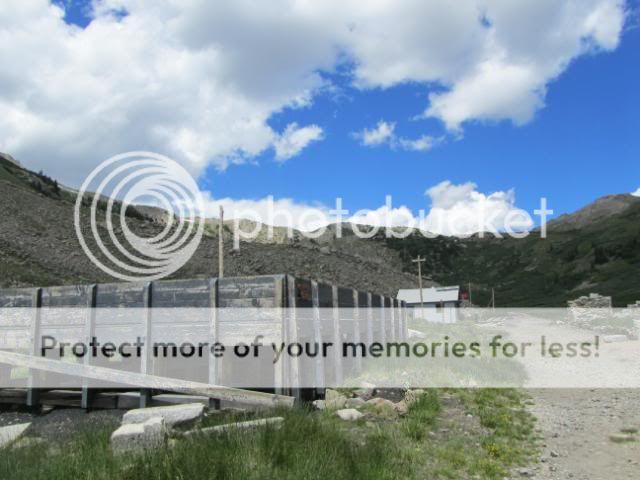
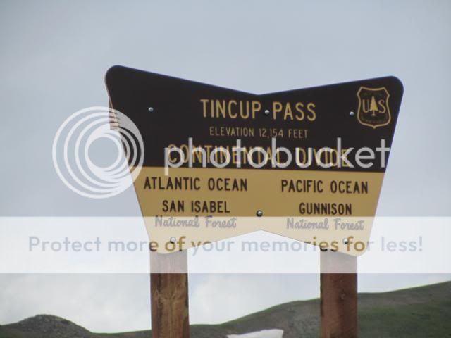
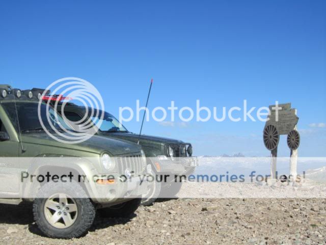
Signage and history at the pass. ![]() 
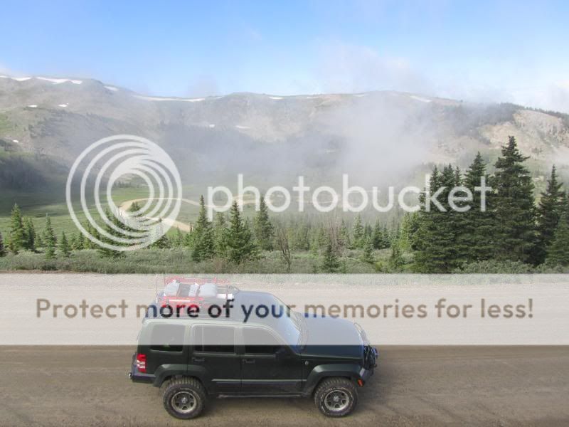
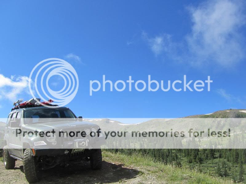
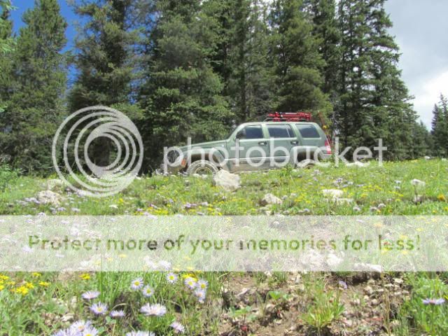
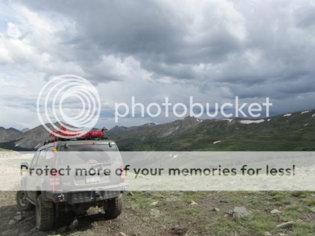
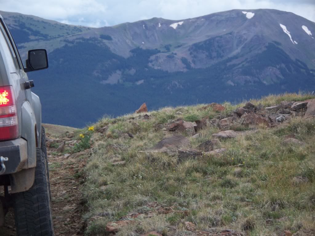
The Kansas-based Libertys enjoy being in the cooler temperatures above 13,000 ft. ![]() 
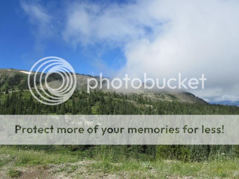
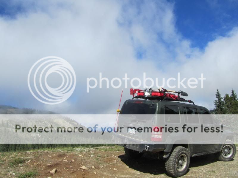
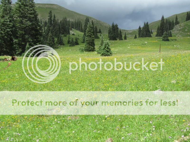
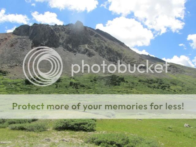
Gorgeous surrounding views. ![]() kskj goes on a little side trip to check out the nearby trail going around the bend above Mosquito Pass. ![]() 
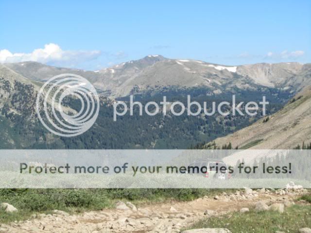
Headin' back to the pass. ![]() 
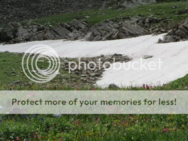
Posing on a snow field on the Alma, CO side of Mosquito Pass. ![]() 
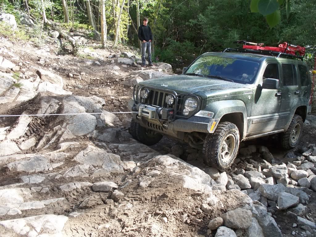
Between a rock and ledge? ![]() 
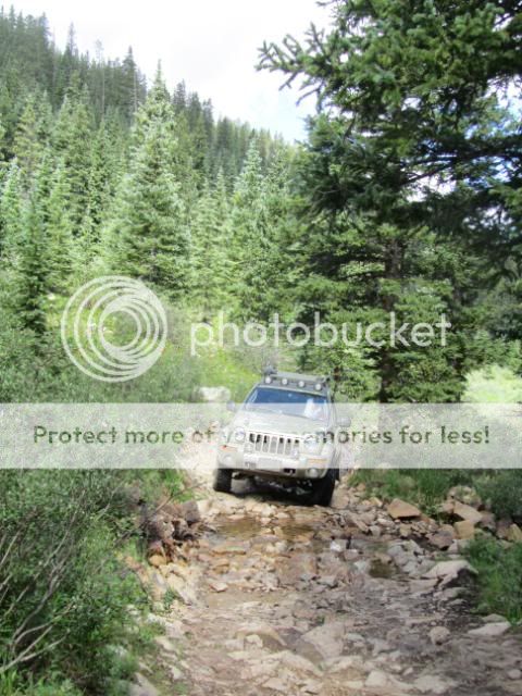
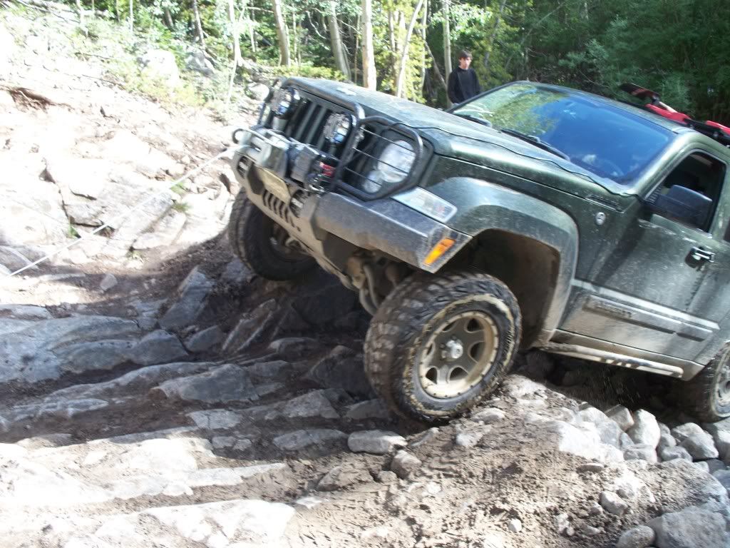
We get to this area where only about 2 weeks before, it was blocked by snow until a group of Wranglers was finally able to winch themselves across. I take the low, rocky route across... ![]() ...and kskj takes the high, one-tire-in-the-snow, route across. ![]() 
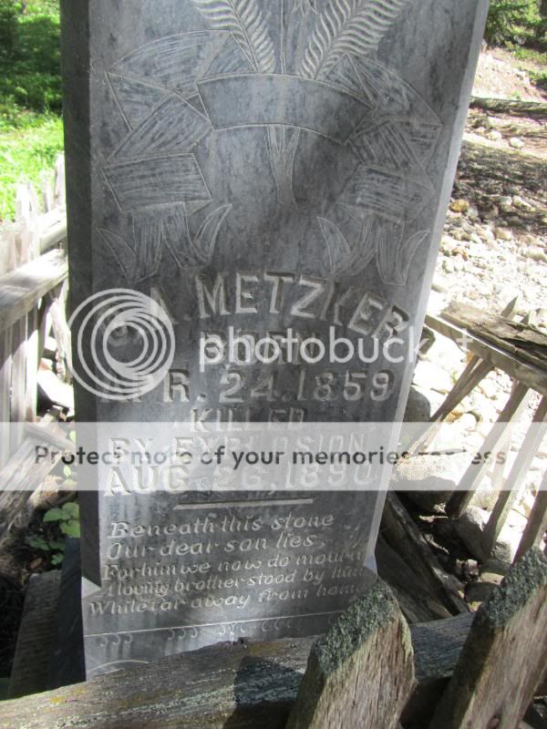
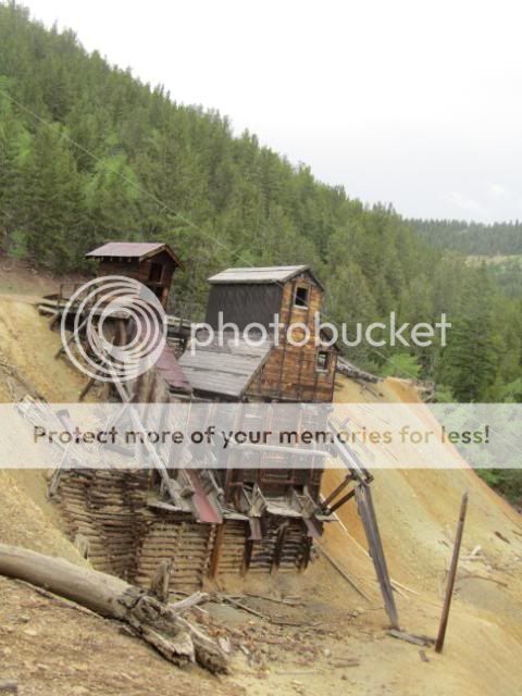
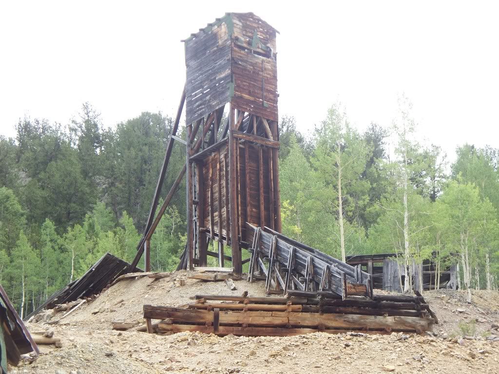
Old Ingersol-Rand air compressor or pump at the North London mine site. ![]() 
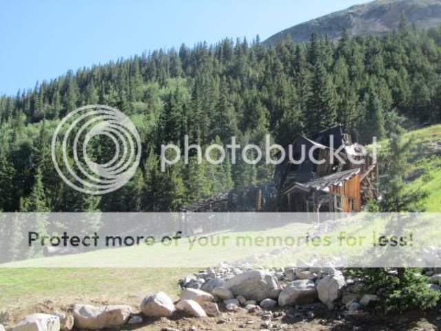
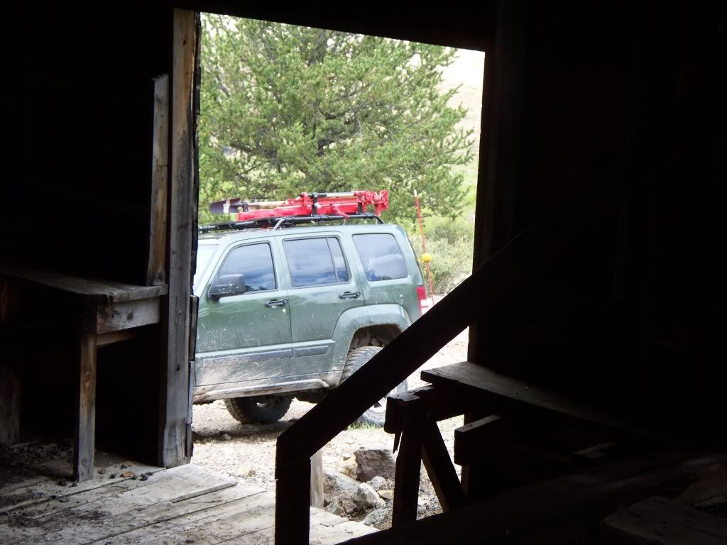
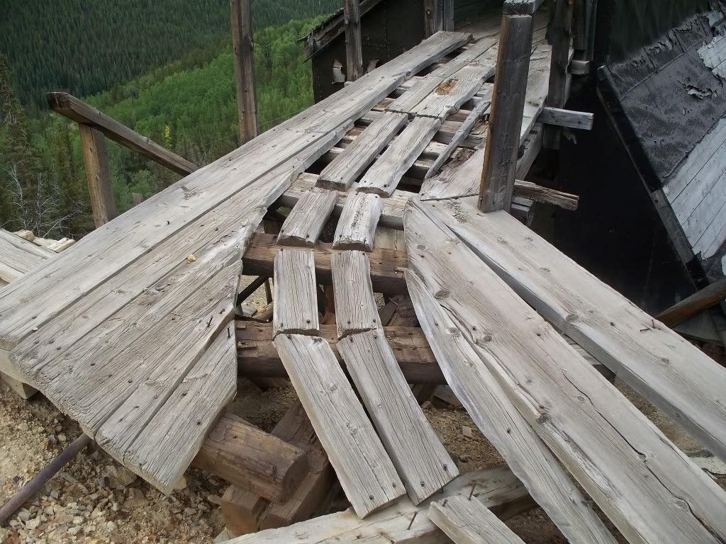
The old North London mine ruins. ![]() 
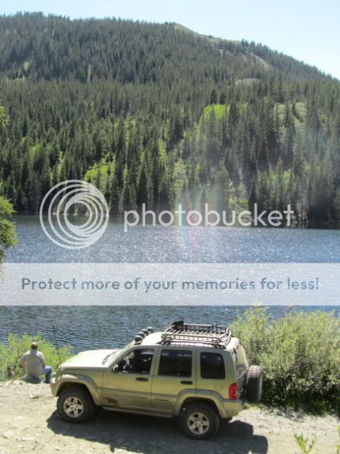
Pure beauty in MtnLuvr's eyes for more than one reason. ![]() 
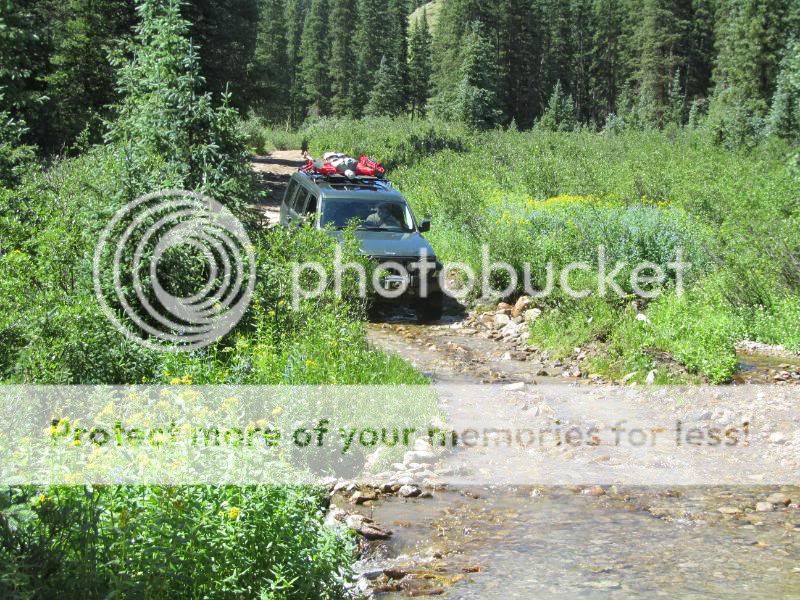
Even this high, the run-off streams have some good volume and speed. ![]() ![]() 
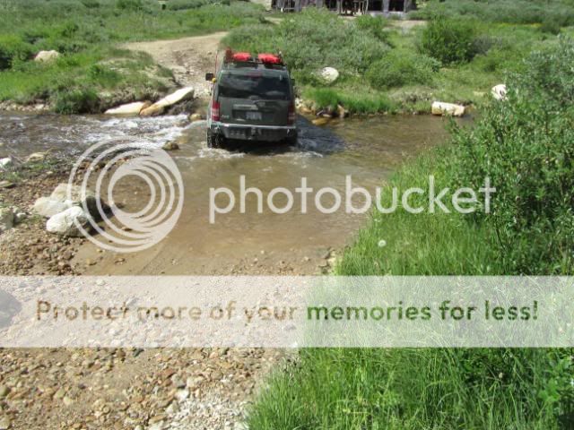
Doin' a little water crossing near another old mine site. ![]() After getting back down the Eastern/Alma side of Mosquito Pass Trail, we turn around and see this ![]() 
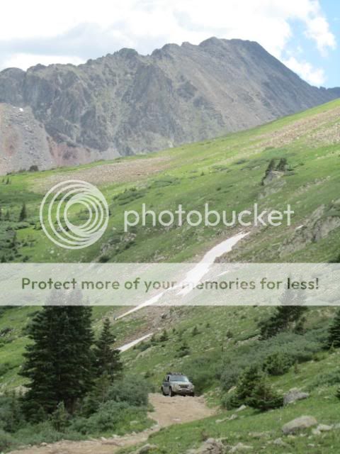
After climbing to over 13,000 ft on Mosquito Pass, we set our sights even higher and want to see how high we can get on the Mount Bross Trail, which as of when I left, was still listed as closed part-way up due to snow. We take the Windy Ridge line up Mount Bross. ![]() kskj playing in a mud puddle as all Jeeps should do. ![]() Looking for directions up Mount Bross? ![]() The KK on the Mount Bross climb, while still low enough for grass and flowers to grow. ![]() 
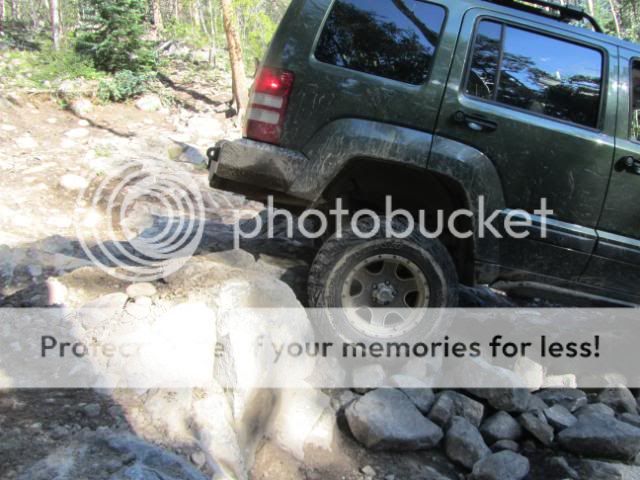
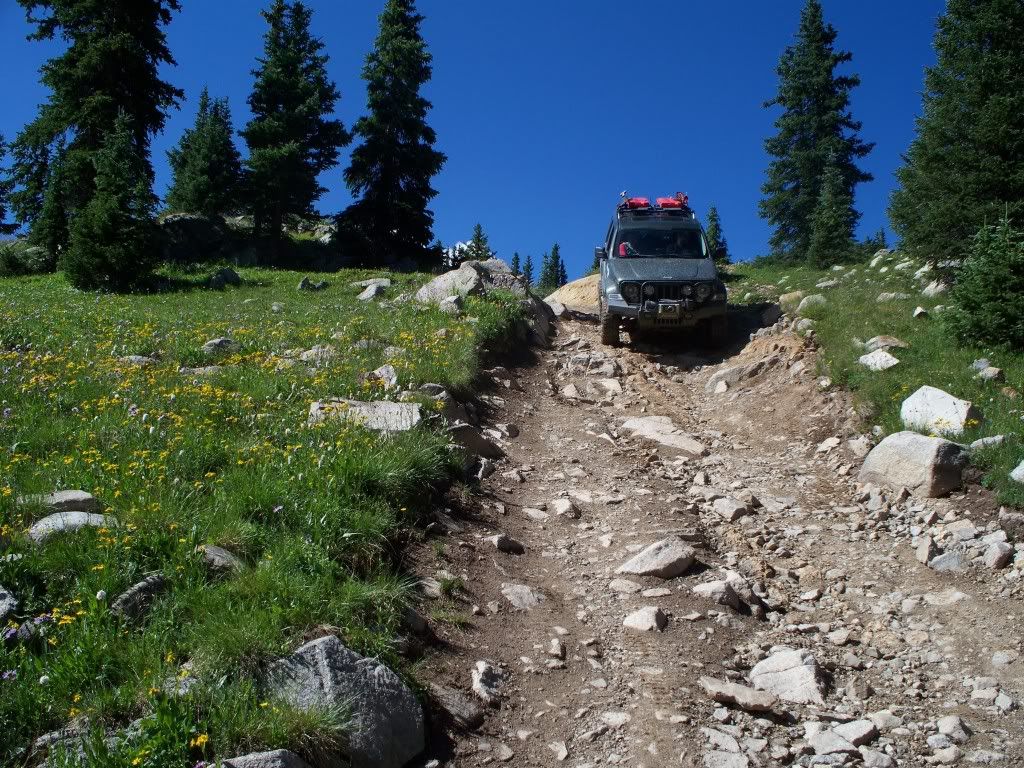
Typical shelf road in the loose rock section above where much can grow. ![]() The Renegade keeps climbing the trail. ![]() 
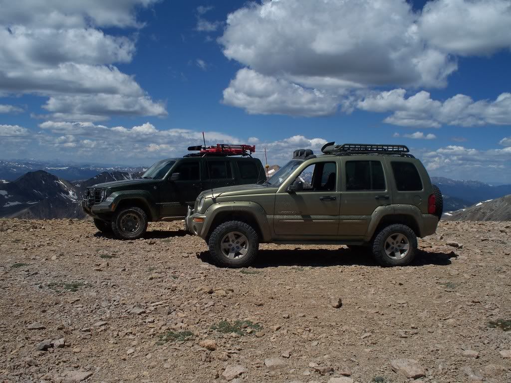
MtnLuvr's KK and kskj's KJ Renegade at the top of Mount Bross. ![]() ![]() 
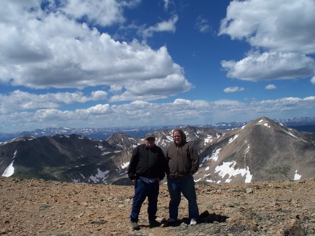
Up at over 14,000 ft elevation. ![]() ![]() Lunch spot with a view part-way back down Mount Bross. Then it was off to Breakneck Pass (a.k.a. Browns Pass) Trail. ![]() This cabin hasn't survived the ravages of time and mountain winters. ![]() kskj doing a little flexing coming down a descent. 
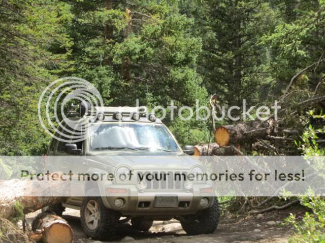
Then we get to a pretty long mud hole, where I was concerned about making it through so I gun the KK as I'm going through. Unbeknownst to me, I lost a front fender plowing through. kskj tells me he saw it sinking in the mud hole as he was plowing through, so there's only one thing to do..... ![]() ...change into some sandals and go wading until I find it beneath the muddy surface ![]() ![]() 
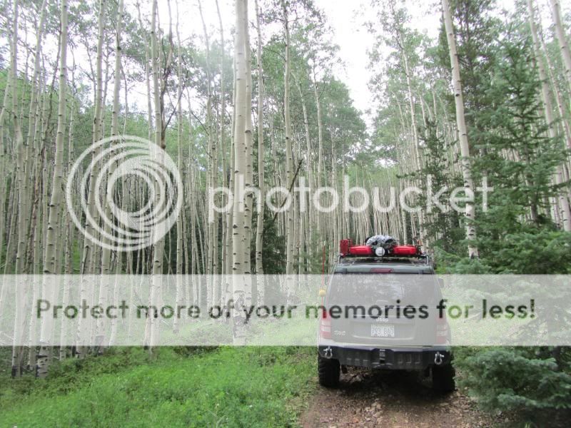
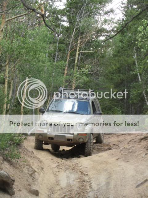
Back on the trail in some scrub aspens. ![]() Breakneck/Browns Pass Trail connects into Weston Pass Trail. We make an FJ eat our dust as we cruise up what little we have left to get to Weston Pass (at a mere 11,921 ft). ![]() ![]() Heading down the Western side of Weston Pass to get back to the Arkansas Headwaters valley South of Leadville, CO. ![]() 
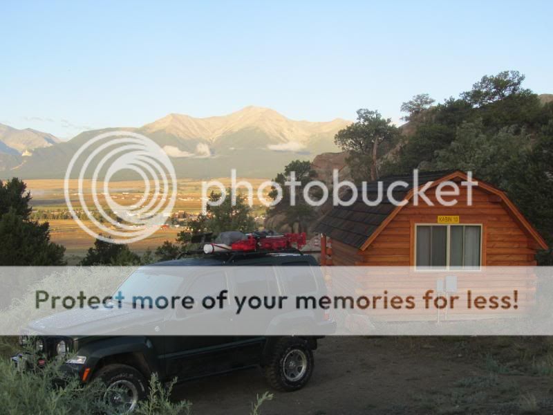
Airing up before hitting the highway back down to our campground West of Salida, CO. ![]() 
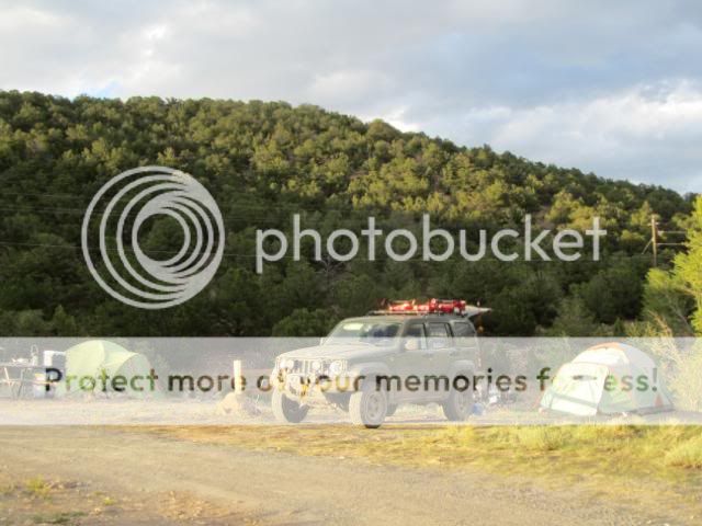
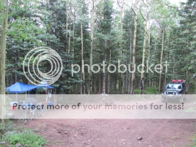
Back at camp as the sun is getting low so we have just enough time for an awesome kskj dinner and to start packing up the vehicles so we can leave early the next morning. While MtnLuvr was still packing up (and showering from his mud-hole fender flare diving excursion), kskj went out for one last quick little night ride.... ![]() 
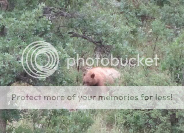
...unfortunately, something along the night ride didn't agree with his KJ. ![]() ![]() The cool mountain mornings, and days, were wonderful. A dry 46F in the morning beats a 105F, high-humidity, Kansas afternoon in July or August anyday! ![]() 
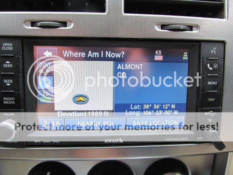
Following kskj back on US-50 toward Canyon City....before we split and went our separate routes back to Eastern Kansas homes. A great mountain excursion with great scenery, enjoyable wheeling, comfortable weather and great company. ![]() |
Author: | kskj [ Mon Aug 08, 2011 11:56 pm ] |
Post subject: | Re: Kansas Libertys (KJ & KK) Cool Off in the Rockies (2011) |
My head photographer did not make this trip so I only have a few good pictures. ![]() ![]() ![]() ![]() A nice little climb ![]() ![]() ![]() ![]() ![]() ![]() My son and I on the top of Mt Bross 14,200 feet ![]() |
Author: | bugnout [ Tue Aug 09, 2011 9:46 am ] |
Post subject: | Re: Kansas Libertys (KJ & KK) Cool Off in the Rockies (2011) |
Great pictures! Looks like you guys had some fun. |
Author: | ABQKJ [ Tue Aug 09, 2011 6:42 pm ] |
Post subject: | Re: Kansas Libertys (KJ & KK) Cool Off in the Rockies (2011) |
It looks like you had a blast. Wish I could have been there..... |
Author: | 2006 KJ [ Wed Aug 17, 2011 9:57 pm ] |
Post subject: | Re: Kansas Libertys (KJ & KK) Cool Off in the Rockies (2011) |
that's incredible! how do you plan a trip like that? where do you get maps... pick trails... plan your route.. keep food fresh.. were/how do you decide to camp? i'd love to plan a cross country trip with my KJ but have no idea where to start. (from PA to CA and back) |
Author: | iMTB [ Thu Aug 18, 2011 9:32 am ] |
Post subject: | Re: Kansas Libertys (KJ & KK) Cool Off in the Rockies (2011) |
Sickest KK (might I even say sickest Liberty) EVER! |
Author: | Voyager [ Sat Sep 03, 2011 8:45 am ] |
Post subject: | Re: Kansas Libertys (KJ & KK) Cool Off in the Rockies (2011) |
Awesome thread, trip, and photos!!! I enjoyed looking at each and every one of them. Thank you for posting these! |
Author: | kskj [ Sat Sep 03, 2011 10:20 am ] |
Post subject: | Re: Kansas Libertys (KJ & KK) Cool Off in the Rockies (2011) |
2006 KJ wrote: that's incredible! how do you plan a trip like that? where do you get maps... pick trails... plan your route.. keep food fresh.. were/how do you decide to camp? i'd love to plan a cross country trip with my KJ but have no idea where to start. (from PA to CA and back) For a lot of trail idea's we go to Traildamage.com. It list most all of the trails in Colorado,trip reports,trail ratings. They also list trails in some other western states. There are some good trail books,check Peter Massey's and Well's trail books. Some trips we just hit the trails until we find a good spot to camp. On this trip we wanted showers and bathrooms so we picked a campground that was close to all the trails we wanted to do. I have a 5 day cooler and buy blocks of ice and have tested it in Utah,It will last 5 day's. Hope this helps now get out and hit the trails you will love it. ![]() |
Author: | John Galt [ Fri Sep 09, 2011 11:30 am ] |
Post subject: | Re: Kansas Libertys (KJ & KK) Cool Off in the Rockies (2011) |
Great write up and pics. We need more of this on the site. Looks like a great time. |
Page 1 of 1 | All times are UTC - 5 hours [ DST ] |
Powered by phpBB © 2000, 2002, 2005, 2007 phpBB Group http://www.phpbb.com/ |