My girlfriend and I spent a few days up at Estes Park in Colorado and went wheeling on one day. Below is our account from our run on May 8, 2006. I have added detailed notes and reference maps.
John
];')
As requested here is a wide view of the area showing the trail in reference to Estes Park, Boulder and Longmont for orientation purposes.

Topo Map (100k) with GPS marked trail and elevation logs. The map was made by running TOPO! on my laptop with a GPS card as we made the run and set to automatically mark where I was every 200 ft. The tracking feature worked better than I thought. You will note on the topo map near the "A" in "National" that the trail from the map goes to the right while my trail marked in red goes to the left. The part to the right was blocked off by crossbuck fences and marked with no trespassing signs. You can actually see where I first went to the right to discover the blockage...The pointy area near the "A". I also have Aerial photos of this run. If anyone wants I can send them files of all my info in this run. I did NOT save all the GPS data. Also note that the elevation profile is reversed with respect to the direction of travel on the trail...for some reason there is no 'reverse' feature on the elevation profile tool...just pay attention to the START and FINISH labels.
Click on link to open main map. Not sure why it won't open on its own.

Driver View of first and most difficult obstacle at mile 0.7.

Wide angle view of upper and lower sections of first obstacle. I took the line on the right side of the lower section

Lower section of first obstacle. Took the line on the right keeping my tires on the high spots on either side of the line.

Close-up of lower section of first obstacle and far view of upper section of first obstacle.

Close-up of upper section of first obstacle. I took the line on the left which is very easy until you reach the large rock you can see at the top...I had a bit of slippage there.

View looking down first obstacle showing drive-around on left. Probably should not use drive-around...Tread Lightly etc...On another note. I did not realize that the drive-around was there until we came back to photograph the first obstacle. Regardless...I don't think it should be used as the main one is easy enough and will not cause undue damage to the trail.

Typical obstacle seen on trail. There are a dozen or so of this class (maybe more). There are also some minor rutted areas but nothing that challenging.

Small mud pit at mile 2.7.

View southeast toward Bulton Rock Resevoir.

View west toward Longs Peak.

View overlooking Big Elk Park/Meadow to the north.

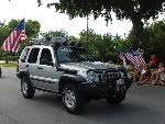
Poser shot of me/KJ/lost T-shirt.


There is a second rock obstacle (mile 0.9) nearly as large as the first one in these photos though it is not as difficult. The second major obstacle is probably the third most challenging. There is also a third major obstacle (mile 1.3) that is about 1/2 as large as the first two and nearly as difficult as this first one. There are alo a few smaller rock obstacles on the downward side that were very easy due to the direction of travel. They would be more of a challeng if one was travelling up them but not as challenging as the three on the way up. (I will add mile posts for these obstacles later). I only got photos of the First major obstacle as in my excitement I took no photos of the major obstacles during the run. We came back to photograph the first obstacle on our way home as it was right at the beginning of the challenging parts.
Lastly below is a list of the notes we took while on the trail with any important information or points of interest. Please
note that all mileages were done on 245/75 R16 tires with a non-corrected speedometer. Innaccuracies should be minimal though.
Mile 0.0-FR 118 diverges to the left from CR 47.
Mile 0.5-Johnny Park Road proper begins at FS gate (open 5/8/2006).
Mile 0.7-First and most difficult rock obstacle.
Mile 0.8-Second opened gate.
Mile 0.9-Second major rock obstacle (3rd most difficult).
Mile 1.3-Large rock obstacle (2nd most difficult).
Mile 1.5-Small obstacle.
Mile 1.6-Small obstacle.
Mile 1.8-1.9Small obstacle and steep grade.
Mile 2.0-Nice view/overlook on left.
Mile 2.1-Easy area of rocky obstacles.
Mile 2.7-Small mud pit followed by another open gate.
Mile 2.8-Area with several good camping sites and side pullouts. Also place where 'old' trail blocked off. Took left fork to continue on.
Mile 3.1-Small obstacle that continues for a stretch.
Mile 3.3-Cobble-size rocks/obstacles.
Mile 3.5-Minor obstacle. Rocks large but only minor obstructions.
Mile 3.8-Nice views of Longs Peak and RMNP.
Mile 4.2-Nice view of Big Elk Meadow on right.
Mile 4.5-Good camping spots.
Mile 5.3-Trail ends at open gate.
Mile 9.3-Following CR 82 for this distance should bring you to HWY 7. Right turn here brings you back to Estes Park
which is about 9 additional miles up HWY 7.