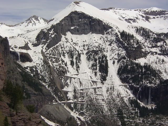
The photo you guys are showing is actually mine, taken by my ex-girlfriend on May 21, 2005, while we were driving on Tomboy Road. Telluride and Ouray are connected by Tomboy Road - Imogene Pass - Camp Bird Road, but the locals generally just call it Imogene Pass. That phot is also my computer's desktop image.
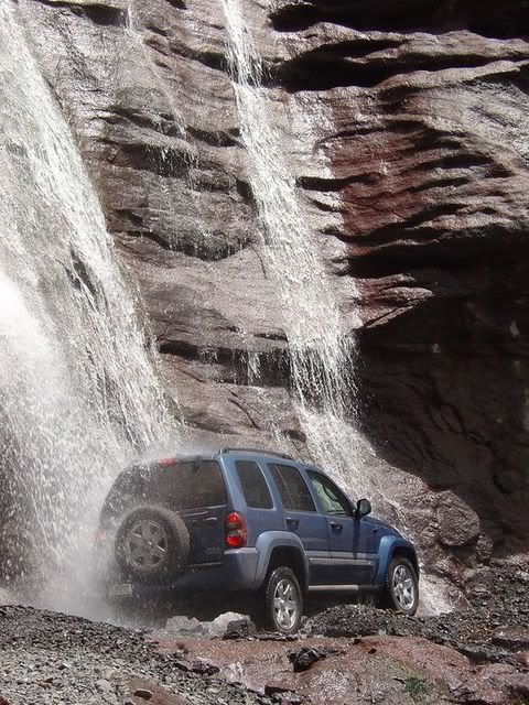
Earlier the same day, we had hiked up to Briday Veil Falls (right side of the picture) wearing shorts. The snow was still 6'+ and undriveable in my then-fairly-new '05 Liberty Ltd. So to indulge my Jeeping addiction, the ex-gf allowed me to drive as far as we could up Tomboy Road, where we took the above photo as well as another spectafular picture of my Liberty going under a waterfall. We had both of these photos printed in 2'x3' poster size.
I just uploaded them to phtobucket, so anyone who wants can have a fresh data file to copy.
And BTW, about 6 weeks after this photo was taken, I did the entirety of Black Bear Road (beginning at US Hwy 550 near Red Mountain Path) in this same vehicle, bone stock and w/o limited slip. Had one hairy spot that I got out of with the help of others (Eddo?), and a lot of the trail involved good ol' skid-plate surfing! Two years later, I still haven't lifted the Liberty. I tinker with old Wagoneers for stuff like that.
[/img]